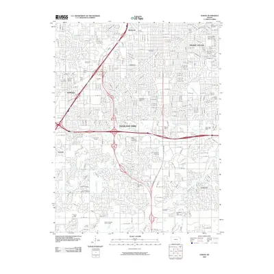
2009 Map of Lenexa
USGS Topo · Published 2009About this map
Overland Park and Lenexa dominate this suburban landscape of Johnson County, Kansas, during a period of dense residential and commercial expansion. The map reveals a complex network of residential streets and arterial highways, centered on the interchange of major routes that separate distinct neighborhoods like Elmhurst and Sunset Hill. A significant concentration of commemorative sites is visible across the quadrangle, ranging from the Woolford Farm Horse Cemetery in the northeast to the sprawling Johnson County Memorial Gardens further south. Educational and administrative hubs are well-established, with the University of Kansas - Edwards campus and the Ottawa University-Kansas City facility serving the growing population. Natural drainage is still evident amidst the development, with Indian Creek and Tomahawk Creek winding through green spaces and golf courses, providing a counterpoint to the dense urban grid.
Find a feature on this map
126 named features on this map. Tap any name to fly to it.
Don’t see what you’re looking for? This feature index may not catch every label — zoom into the map to look around manually.
Map Details
Editions of this 2009 Lenexa Map
This is the sole edition of this map. No revisions or reprints were ever made.
Other maps of this area

1887 · Olathe
USGS Topo · 1:125,000

1890 · Kansas City
USGS Topo · 1:125,000

1893 · Olathe
USGS Topo · 1:125,000

1894 · Kansas City
USGS Topo · 1:125,000

1934 · Bonner Springs
USGS Topo · 1:48,000

1934 · Grandview
USGS Topo · 1:24,000

1934 · Shawnee
USGS Topo · 1:24,000

1934 · Edwardsville
USGS Topo · 1:24,000

1935 · Olathe
USGS Topo · 1:24,000

1935 · Kansas City
USGS Topo · 1:24,000