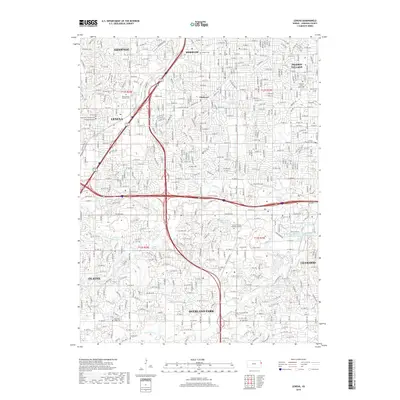
2018 Map of Lenexa
USGS Topo · Published 2018About this map
Overland Park and the neighboring cities of Lenexa and Shawnee dominate this modern survey of Johnson County, showing a landscape defined by extensive suburban development and a sophisticated network of parkways. The map captures several legacy sites that predate the surrounding residential expansion, including the Linwood Pioneer Cem and the Antioch Cem. Water features such as Indian Cr and Tomahawk Cr are integrated into the modern community through sites like Stoll Park Lake and the Tomahawk Parkway North Pond system. This 2018 record illustrates the transition from earlier agricultural tracts like Elmhurst to a fully developed metropolitan corridor. Researchers can trace the layout of significant memorial sites, including the Strang Mausoleum and the Johnson County Memorial Gardens, within the contemporary street grid of Olathe and Leawood.
Find a feature on this map
140 named features on this map. Tap any name to fly to it.
Don’t see what you’re looking for? This feature index may not catch every label — zoom into the map to look around manually.
Map Details
Editions of this 2018 Lenexa Map
This is the sole edition of this map. No revisions or reprints were ever made.
Other maps of this area

1887 · Olathe
USGS Topo · 1:125,000

1890 · Kansas City
USGS Topo · 1:125,000

1893 · Olathe
USGS Topo · 1:125,000

1894 · Kansas City
USGS Topo · 1:125,000

1934 · Bonner Springs
USGS Topo · 1:48,000

1934 · Grandview
USGS Topo · 1:24,000

1934 · Shawnee
USGS Topo · 1:24,000

1934 · Edwardsville
USGS Topo · 1:24,000

1935 · Olathe
USGS Topo · 1:24,000

1935 · Kansas City
USGS Topo · 1:24,000