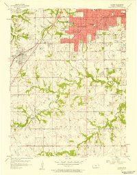
1957 Map of Lenexa
USGS Topo · Published 1958About this map
Overland Park and Prairie Village expand across the northeastern landscape during this mid-century period of rapid suburbanization in Johnson County. The red-shaded urban areas contrast with the rural character of Oxford and Mission Twp, where numerous local schoolhouses such as Countryside Sch, Lone Star Sch, and Belleview Sch still anchor the agricultural community. The St Louis San Francisco railroad cuts a diagonal path through Lenexa, reflecting the historical transportation corridor that shaped these early settlements.
Find a feature on this map
38 named features on this map. Tap any name to fly to it.
Don’t see what you’re looking for? This feature index may not catch every label — zoom into the map to look around manually.
Map Details
Editions of this 1957 Lenexa Map
This is the sole edition of this map. No revisions or reprints were ever made.
Other maps of this area

1887 · Olathe
USGS Topo · 1:125,000

1890 · Kansas City
USGS Topo · 1:125,000

1893 · Olathe
USGS Topo · 1:125,000

1894 · Kansas City
USGS Topo · 1:125,000

1934 · Bonner Springs
USGS Topo · 1:48,000

1934 · Grandview
USGS Topo · 1:24,000

1934 · Shawnee
USGS Topo · 1:24,000

1934 · Edwardsville
USGS Topo · 1:24,000

1935 · Olathe
USGS Topo · 1:24,000

1935 · Kansas City
USGS Topo · 1:24,000