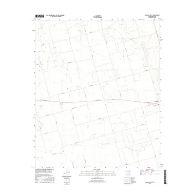
2016 Map of Lenorah West
USGS Topo · Published 2016About this map
Lenorah serves as a central point of reference on this Texas panhandle landscape, where the intersection of Ranch Rd 87 and Lenorah Loop anchors the local transportation network. The terrain is defined by the ephemeral passage of Mustang Draw, which cuts a subtle path through the section lines and farm-to-market roads that partition the high plains. Extensive road networks, including FM 829 and FM 2002, reveal the orderly grid of Martin County land management. The presence of numerous small depressions and catchment areas throughout the quadrant indicates the typical playa lake geology of the region, while labels like Fence Line and Woodward Rd reflect the enduring agricultural and ranching foundations of this West Texas community.
Find a feature on this map
24 named features on this map. Tap any name to fly to it.
Don’t see what you’re looking for? This feature index may not catch every label — zoom into the map to look around manually.
Map Details
Editions of this 2016 Lenorah West Map
This is the sole edition of this map. No revisions or reprints were ever made.
Other maps of this area

1954 · Hobbs
USGS Topo · 1:250,000

1954 · Big Spring
USGS Topo · 1:250,000

1958 · Big Spring
USGS Topo · 1:250,000

1958 · Hobbs
USGS Topo · 1:250,000

1966 · Wolcott Ranch
USGS Topo · 1:24,000

1966 · Merrick
USGS Topo · 1:24,000

1966 · Lenorah West
USGS Topo · 1:24,000

1966 · Flynt Ranch
USGS Topo · 1:24,000

1966 · Flower Grove
USGS Topo · 1:24,000

1966 · North Curtis Ranch
USGS Topo · 1:24,000