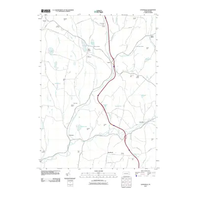
2010 Map of Lenoxville
USGS Topo · Published 2010About this map
Tunkhannock Creek and its East Branch serve as the primary geographical anchors for this section of Susquehanna County, where several small hamlets remain centered on historic crossroads and watercourses. The village of Lenoxville sits at the junction of the east branch, while Glenwood and Marshbrook occupy the southern reaches of the map. The persistence of local history is visible through numerous family-named landmarks and resting places, such as Harding Cemetery and South Gibson Cemetery.
Find a feature on this map
95 named features on this map. Tap any name to fly to it.
Don’t see what you’re looking for? This feature index may not catch every label — zoom into the map to look around manually.
Map Details
Editions of this 2010 Lenoxville Map
This is the sole edition of this map. No revisions or reprints were ever made.
Other maps of this area

1892 · Dundaff
USGS Topo · 1:62,500

1932 · Susquehanna
USGS Topo · 1:62,500

1935 · Susquehanna
USGS Topo · 1:62,500

1943 · Montrose
USGS Topo · 1:62,500

1945 · Montrose
USGS Topo · 1:62,500

1946 · Tunkhannock
USGS Topo · 1:62,500

1946 · Dalton
USGS Topo · 1:24,000

1946 · Carbondale
USGS Topo · 1:24,000

1946 · Factoryville
USGS Topo · 1:24,000
1946 · Clifford
USGS Topo · 1:24,000
Featured Places
- Clifford Township, PA
- Lenox Township, PA
- Harford Township, PA
- Gibson Township, PA
- Marshbrook, Benton Township