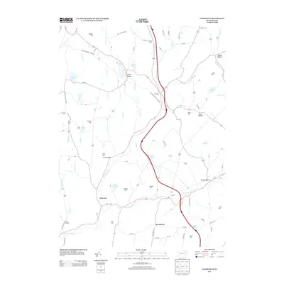
2013 Map of Lenoxville
USGS Topo · Published 2013About this map
Lenoxville and the surrounding Susquehanna County hamlets sit within a landscape defined by the branching waters of Tunkhannock Cr. The map details a traditional Pennsylvania rural network where small settlements like West Lenox, East Lenox, and Lenox are linked by historic thoroughfares such as the Milford and Owego Turnpike Rd and the Brooklyn and Lenox Tpke. To the south, the village of Glenwood marks the junction where the East Branch Tunkhannock Cr meets the main stem, while the southern edge of the sheet identifies the path of Railroad 2. The terrain is punctuated by family-named landmarks including Gunn Hill, Hartley Hill, and Carey Hill, illustrating a long history of local land ownership. Numerous smaller ponds and lakes, such as Horton Lake and Robinson Lake, are scattered across the uplands between the creek valleys.
Find a feature on this map
67 named features on this map. Tap any name to fly to it.
Don’t see what you’re looking for? This feature index may not catch every label — zoom into the map to look around manually.
Map Details
Editions of this 2013 Lenoxville Map
This is the sole edition of this map. No revisions or reprints were ever made.
Other maps of this area

1892 · Dundaff
USGS Topo · 1:62,500

1932 · Susquehanna
USGS Topo · 1:62,500

1935 · Susquehanna
USGS Topo · 1:62,500

1943 · Montrose
USGS Topo · 1:62,500

1945 · Montrose
USGS Topo · 1:62,500

1946 · Tunkhannock
USGS Topo · 1:62,500

1946 · Dalton
USGS Topo · 1:24,000

1946 · Carbondale
USGS Topo · 1:24,000

1946 · Factoryville
USGS Topo · 1:24,000
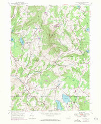
1946 · Clifford
USGS Topo · 1:24,000
Featured Places
- Clifford Township, PA
- Lenox Township, PA
- Harford Township, PA
- Gibson Township, PA
- Marshbrook, Benton Township