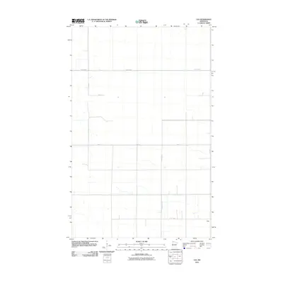
2010 Map of Leo
USGS Topo · Published 2010About this map
Leo sits as the primary named settlement in this northern Roseau County landscape, characterized by a highly organized grid of rural roads and agricultural drainage. Surveyed in 2009 and 2010, the terrain shows a clear reliance on a systematic infrastructure of county highways and local avenues to manage the low-lying geography. The alignment of County Hwy-7 and County Hwy-101 dictates the movement of residents and goods through this sparsely populated border region. Genealogists and local historians can use this survey to pinpoint specific rural properties along corridors like 120th Ave and 300th St, which trace the section lines of the Public Land Survey System. The map serves as a record of the modern rural road network, showing the precise locations of intersections such as where County Hwy-23 meets 170th Ave near the community of Leo.
Find a feature on this map
8 named features on this map. Tap any name to fly to it.
Don’t see what you’re looking for? This feature index may not catch every label — zoom into the map to look around manually.
Map Details
Editions of this 2010 Leo Map
This is the sole edition of this map. No revisions or reprints were ever made.
Other maps of this area

1918 · Greenbush
USGS Topo · 1:62,500

1919 · Pelan
USGS Topo · 1:62,500

1919 · Badger
USGS Topo · 1:62,500

1930 · Juneberry
USGS Topo · 1:31,680

1932 · Juneberry
USGS Topo · 1:62,500

1952 · Thief River Falls
USGS Topo · 1:250,000

1956 · Thief River Falls
USGS Topo · 1:250,000

1957 · Thief River Falls
USGS Topo · 1:250,000

1957 · Pelan
USGS Topo · 1:62,500
1962 · Greenbush
USGS Topo · 1:24,000