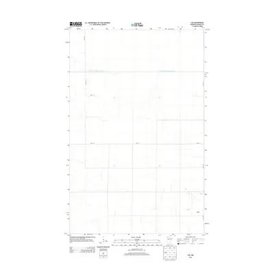
2013 Map of Leo
USGS Topo · Published 2013About this map
The small community of Leo defines the human footprint in this northern Roseau County landscape, situated near the Canadian border. This 2013 survey illustrates the extensive drainage infrastructure required to manage the low-lying terrain, most notably the State Ditch Number Seventytwo which traverses the northern section of the quadrangle. The township is organized by a precise grid of local roads, including 120th Ave and 170th Ave, connecting isolated farmsteads across the flat, open plains. This map is particularly valuable for genealogists and local historians tracking the modern layout of the rural Leo area, showing the persistent agricultural patterns and the specific alignment of thoroughfares like 280th St and 300th St that serve this remote corner of Minnesota.
Find a feature on this map
6 named features on this map. Tap any name to fly to it.
Don’t see what you’re looking for? This feature index may not catch every label — zoom into the map to look around manually.
Map Details
Editions of this 2013 Leo Map
This is the sole edition of this map. No revisions or reprints were ever made.
Other maps of this area

1918 · Greenbush
USGS Topo · 1:62,500

1919 · Pelan
USGS Topo · 1:62,500

1919 · Badger
USGS Topo · 1:62,500

1930 · Juneberry
USGS Topo · 1:31,680

1932 · Juneberry
USGS Topo · 1:62,500

1952 · Thief River Falls
USGS Topo · 1:250,000

1956 · Thief River Falls
USGS Topo · 1:250,000

1957 · Thief River Falls
USGS Topo · 1:250,000

1957 · Pelan
USGS Topo · 1:62,500
1962 · Greenbush
USGS Topo · 1:24,000