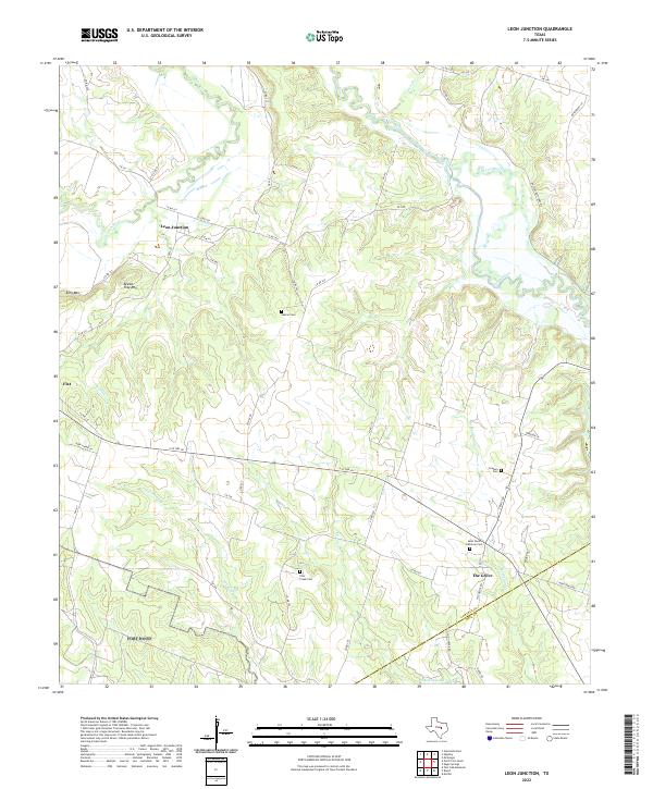
2022 Map of Leon Junction
USGS Topo · Published 2022About this map
The Leon River carves a winding path through the northern landscape of this Central Texas region, marking a sharp contrast to the high points of King Mtn and Bread Tray Mtn further south. This area, spanning the border of Coryell and Bell Counties, centers on rural settlements like Leon Junction and The Grove. The distribution of burial sites, including Saint Pauls Lutheran Cem, Seaton Cem, and the Flint Creek Cem, points to established community centers that have anchored these ranching and farming lands for generations. Numerous small tributaries, such as Metheglin Cr and Preachers Cr, drain the undulating terrain toward the main river. The modern road network follows historic routes like S ST HW 36, connecting the smaller hamlets of Flat to the broader regional economy while maintaining the distinctively open character of the Texas hill country.
Find a feature on this map
57 named features on this map. Tap any name to fly to it.
Don’t see what you’re looking for? This feature index may not catch every label — zoom into the map to look around manually.
Map Details
Editions of this 2022 Leon Junction Map
This is the sole edition of this map. No revisions or reprints were ever made.
Other maps of this area

1892 · Temple
USGS Topo · 1:125,000

1894 · Gatesville
USGS Topo · 1:125,000

1924 · Gatesville 4-a
USGS Topo · 1:48,000

1924 · Temple 2-C
USGS Topo · 1:48,000

1924 · Temple 3-B
USGS Topo · 1:48,000

1930 · Killeen
USGS Topo · 1:62,500

1931 · Mc Gregor
USGS Topo · 1:62,500

1931 · Belton
USGS Topo · 1:62,500

1947 · Bland
USGS Topo · 1:24,000

1947 · Post Oak Mountain
USGS Topo · 1:24,000