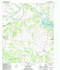
1995 Map of Leon Junction
USGS Topo · Published 1995About this map
Leon Junction sits at a crossroads of transportation history, where the path of the Leon River meets the remnant of an Old Railroad Grade. This Central Texas landscape transitions from the upland relief of Bread Tray Mountain and King Mountain toward the backwaters of Belton Lake. The map details a deeply rooted rural community, preserving the locations of numerous family and congregational burial grounds including Seeton Cem, St Paul Cem, and Flint Creek Cemetery. To the south, the boundary of the Fort Hood Military Reservation suggests the mid-twentieth century expansion of military training grounds, while the Iron Bridge Wildlife Mgmt Area along the river bottom indicates modern conservation efforts. Local life is further anchored by landmarks such as Cold Springs Ch and a post office at The Grove.
Find a feature on this map
28 named features on this map. Tap any name to fly to it.
Don’t see what you’re looking for? This feature index may not catch every label — zoom into the map to look around manually.
Map Details
Editions of this 1995 Leon Junction Map
This is the sole edition of this map. No revisions or reprints were ever made.
Other maps of this area

1892 · Temple
USGS Topo · 1:125,000

1894 · Gatesville
USGS Topo · 1:125,000

1924 · Gatesville 4-a
USGS Topo · 1:48,000

1924 · Temple 2-C
USGS Topo · 1:48,000

1924 · Temple 3-B
USGS Topo · 1:48,000

1930 · Killeen
USGS Topo · 1:62,500

1931 · Mc Gregor
USGS Topo · 1:62,500

1931 · Belton
USGS Topo · 1:62,500

1947 · Bland
USGS Topo · 1:24,000

1947 · Post Oak Mountain
USGS Topo · 1:24,000