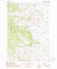
1988 Map of Leonard Creek
USGS Topo · Published 1989About this map
The Tobacco Root Mountains define the high elevations of this 1988 survey, where the drainages of the Beaverhead National Forest reveal a history of resource extraction. The northern reach of the quadrangle is notably marked by mining activity near Aurora Creek, featuring a Mine Shaft, an Adit, and several Prospect labels. This network of mineral exploration is situated among a complex system of waterways, including Leonard Creek and Log Creek, which flow through the steep terrain.
Find a feature on this map
30 named features on this map. Tap any name to fly to it.
Don’t see what you’re looking for? This feature index may not catch every label — zoom into the map to look around manually.
Map Details
Editions of this 1988 Leonard Creek Map
This is the sole edition of this map. No revisions or reprints were ever made.
Other maps of this area

1888 · Three Forks
USGS Topo · 1:250,000

1894 · Three Forks
USGS Topo · 1:250,000

1895 · Three Forks
USGS Topo · 1:250,000

1947 · Bozeman
USGS Topo · 1:250,000

1948 · Bozeman
USGS Topo · 1:250,000

1949 · Ennis
USGS Topo · 1:62,500

1949 · Norris
USGS Topo · 1:62,500

1950 · Harrison
USGS Topo · 1:62,500

1950 · Virginia City
USGS Topo · 1:62,500

1951 · Norris
USGS Topo · 1:62,500