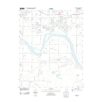
2012 Map of Leonard
USGS Topo · Published 2012About this map
The Arkansas River winds through the heart of this Oklahoma landscape, carving a broad valley between the northern residential expansion and the rising Conjada Mountains to the southeast. In the early 21st century, the settlement of Leonard remains a focal point south of the river, while the area to the north shows a dense grid of residential streets like E 121st St S and S 118th E Ave. For genealogists and local historians, the map is remarkably well-documented with family and community burial sites, including the White Church Cem, Simmons Cem, and Sanger Cem. To the south, Bixhoma Lake and the meandering Snake Cr provide a distinct contrast to the more structured suburban development near Haikey Cr. This layout highlights the transition between the modern growth and the older rural foundations of Tulsa County.
Find a feature on this map
123 named features on this map. Tap any name to fly to it.
Don’t see what you’re looking for? This feature index may not catch every label — zoom into the map to look around manually.
Map Details
Editions of this 2012 Leonard Map
This is the sole edition of this map. No revisions or reprints were ever made.
Other maps of this area

1896 · Okmulgee
USGS Topo · 1:125,000

1900 · Okmulgee
USGS Topo · 1:125,000

1901 · Claremore
USGS Topo · 1:125,000

1914 · Claremore
USGS Topo · 1:125,000

1916 · Claremore
USGS Topo · 1:125,000

1946 · Fort Smith
USGS Topo · 1:250,000

1952 · Jenks
USGS Topo · 1:24,000

1954 · Tulsa
USGS Topo · 1:250,000

1955 · Broken Arrow
USGS Topo · 1:24,000

1957 · Leonard
USGS Topo · 1:24,000