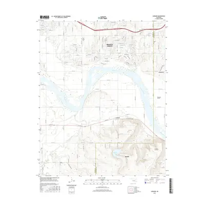
2016 Map of Leonard
USGS Topo · Published 2016About this map
The Arkansas River carves a broad valley through the center of this landscape, separating the southern suburban reaches of Broken Arrow from the rural expanse of southern Tulsa and Wagoner Counties. This environment is defined by the sharp contrast between the upland heights of the Conjada Mountains and the low-lying agricultural lands of the Kadashan Bottom. The settlement of Leonard sits at the base of these hills, marking a point where the road network transitions from a rigid grid into the winding paths of the higher elevations near Bixhoma Lake.
Find a feature on this map
31 named features on this map. Tap any name to fly to it.
Don’t see what you’re looking for? This feature index may not catch every label — zoom into the map to look around manually.
Map Details
Editions of this 2016 Leonard Map
This is the sole edition of this map. No revisions or reprints were ever made.
Other maps of this area

1896 · Okmulgee
USGS Topo · 1:125,000

1900 · Okmulgee
USGS Topo · 1:125,000

1901 · Claremore
USGS Topo · 1:125,000

1914 · Claremore
USGS Topo · 1:125,000

1916 · Claremore
USGS Topo · 1:125,000

1946 · Fort Smith
USGS Topo · 1:250,000

1952 · Jenks
USGS Topo · 1:24,000

1954 · Tulsa
USGS Topo · 1:250,000

1955 · Broken Arrow
USGS Topo · 1:24,000

1957 · Leonard
USGS Topo · 1:24,000