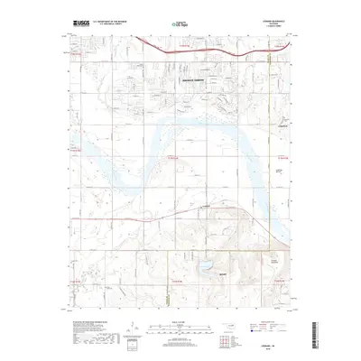
2018 Map of Leonard
USGS Topo · Published 2018About this map
The Arkansas River carves a broad valley through this landscape southeast of Broken Arrow, marking the boundary where Tulsa and Wagoner Counties meet. This survey shows a transition from suburban expansion in the north to the dramatic elevation changes of the Conjada Mountains in the south, where Bixhoma Lake is situated. The bottomlands along the river, including Kadashan Bottom, contrast with the upland ridges that rise sharply toward the southern edge of the sheet. For genealogists and local historians, the map is a significant record of rural burial sites, featuring the White Church Cem, Apueka Cem, Simmons Cem, and Snake Creek Cem. Small settlements like Leonard and portions of Bixby and Coweta are documented alongside drainage systems like Snake Creek and Haikey Cr, which have long influenced the region's agricultural and developmental patterns.
Find a feature on this map
27 named features on this map. Tap any name to fly to it.
Don’t see what you’re looking for? This feature index may not catch every label — zoom into the map to look around manually.
Map Details
Editions of this 2018 Leonard Map
This is the sole edition of this map. No revisions or reprints were ever made.
Other maps of this area

1896 · Okmulgee
USGS Topo · 1:125,000

1900 · Okmulgee
USGS Topo · 1:125,000

1901 · Claremore
USGS Topo · 1:125,000

1914 · Claremore
USGS Topo · 1:125,000

1916 · Claremore
USGS Topo · 1:125,000

1946 · Fort Smith
USGS Topo · 1:250,000

1952 · Jenks
USGS Topo · 1:24,000

1954 · Tulsa
USGS Topo · 1:250,000

1955 · Broken Arrow
USGS Topo · 1:24,000

1957 · Leonard
USGS Topo · 1:24,000