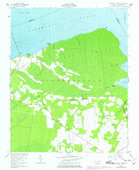
1954 Map of Leonards Point
USGS Topo · Published 1977About this map
Albemarle Sound and the extensive Big Swamp dominate this coastal landscape on the edge of Washington County. The transition from the open waters of the sound to the dense wetlands is marked by small settlements like Skinnersville and Pea Ridge, where human activity centers around narrow lanes and landings. Along the shoreline, Shadberry Landing and Newberry Landing indicate the historical importance of water access for this isolated community. Farther inland, the environment is shaped by a network of drainage features like Straight Creek and the Newberry Ditch. Cultural life is anchored by local congregations at Piney Grove Ch, Scuppernong Ch, and Mt Pleasant Ch. A significant portion of the southern interior is designated as a State Reservation, featuring a Lookout Tower that served as a critical vantage point over the timber and peat lands of the Inner Banks.
Find a feature on this map
32 named features on this map. Tap any name to fly to it.
Don’t see what you’re looking for? This feature index may not catch every label — zoom into the map to look around manually.
Map Details
Editions of this 1954 Leonards Point Map
2 editions found
Other maps of this area

1904 · Edenton
USGS Topo · 1:62,500

1906 · Hertford
USGS Topo · 1:62,500

1940 · Hertford
USGS Topo · 1:62,500

1942 · Edenton
USGS Topo · 1:62,500

1943 · Columbia
USGS Topo · 1:125,000

1943 · Plymouth
USGS Topo · 1:125,000

1943 · Edenton
USGS Topo · 1:62,500

1953 · Norfolk
USGS Topo · 1:250,000

1953 · Columbia West
USGS Topo · 1:24,000

1953 · Rocky Mount
USGS Topo · 1:250,000