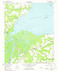
1954 Map of Westover
USGS Topo · Published 1978About this map
The Roanoke River delta meets the waters of Albemarle Sound in this detailed map of the lowlands where Bertie and Washington counties converge. The complex aquatic landscape is defined by the Cashie River, Conary Creek, and Eastmost River, which carve out a network of landforms including Goodmans Island and Rice Island. Industrial and agricultural infrastructure is evident through the Tidewater Experiment Station and the Norfolk Southern railway lines that connect the local settlements. Cultural history is anchored by several rural congregations such as Socona Ch and Saints Delight Ch, reflecting the dispersed community structure of the mid-20th century. The presence of Riverside Airport and a Sewage Disposal plant near Plymouth indicates the modernization occurring on the outskirts of the larger town during the postwar period.
Find a feature on this map
42 named features on this map. Tap any name to fly to it.
Don’t see what you’re looking for? This feature index may not catch every label — zoom into the map to look around manually.
Map Details
Editions of this 1954 Westover Map
2 editions found

Other maps of this area

1904 · Edenton
USGS Topo · 1:62,500

1942 · Edenton
USGS Topo · 1:62,500

1943 · Plymouth
USGS Topo · 1:125,000

1943 · Edenton
USGS Topo · 1:62,500

1953 · Norfolk
USGS Topo · 1:250,000

1953 · Rocky Mount
USGS Topo · 1:250,000

1954 · Rocky Mount
USGS Topo · 1:250,000

1954 · Plymouth East
USGS Topo · 1:24,000

1954 · Roper North
USGS Topo · 1:24,000

1954 · Roper South
USGS Topo · 1:24,000