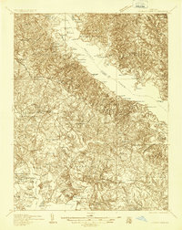
1936 Map of Leonardtown
USGS Topo · Published 1936About this map
Leonardtown and the surrounding riverine landscape of St. Mary's County are documented here during the mid-1930s, revealing a society deeply tied to the tidewater. The Patuxent River and Saint Clement Bay dominate the geography, lined with historical landings and wharves such as Williams Wharf and Jones Wharf that served as vital conduits for commerce before modern highway dominance. Inland, the importance of faith and education in rural Maryland is evident through the dense placement of sites like Old All Faith Ch, Our Ladys Chapel, and numerous local schoolhouses including Gravelly Knoll Sch and Bayside Sch.
Find a feature on this map
114 named features on this map. Tap any name to fly to it.
Don’t see what you’re looking for? This feature index may not catch every label — zoom into the map to look around manually.
Map Details
Editions of this 1936 Leonardtown Map
This is the sole edition of this map. No revisions or reprints were ever made.
Other maps of this area

1892 · Leonardtown
USGS Topo · 1:62,500

1892 · Drum Point
USGS Topo · 1:62,500

1892 · Prince Frederick
USGS Topo · 1:62,500

1892 · Brandywine
USGS Topo · 1:62,500

1892 · Piney Point
USGS Topo · 1:62,500

1892 · Montross
USGS Topo · 1:62,500

1893 · Sharps Island
USGS Topo · 1:62,500

1894 · Wicomico
USGS Topo · 1:62,500

1894 · Piney Point
USGS Topo · 1:62,500

1894 · Point Lookout
USGS Topo · 1:62,500
Featured Places
- Lexington Park, MD
- California, Lexington Park
- Wildewood, Lexington Park
- Golden Beach, MD
- Leonardtown, MD