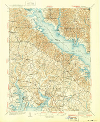
1939 Map of Leonardtown
USGS Topo · Published 1939About this map
Leonardtown serves as the focal point of this 1930s survey, situated along the wide waters of Breton Bay. The map captures a landscape defined by its deep relationship with the Patuxent River and the complex tidal inlets of St Clement Bay and Cuckold Creek. This era of Southern Maryland history is recorded through a dense network of local schools and churches, including the Bannaker Sch, Hickory Hill Sch, and the historic St Andrews Ch located at the junction of St Andrews Church Road.
Find a feature on this map
131 named features on this map. Tap any name to fly to it.
Don’t see what you’re looking for? This feature index may not catch every label — zoom into the map to look around manually.
Map Details
Editions of this 1939 Leonardtown Map
3 editions found
Other maps of this area

1892 · Leonardtown
USGS Topo · 1:62,500

1892 · Drum Point
USGS Topo · 1:62,500

1892 · Prince Frederick
USGS Topo · 1:62,500

1892 · Brandywine
USGS Topo · 1:62,500

1892 · Piney Point
USGS Topo · 1:62,500

1892 · Montross
USGS Topo · 1:62,500

1893 · Sharps Island
USGS Topo · 1:62,500

1894 · Wicomico
USGS Topo · 1:62,500

1894 · Piney Point
USGS Topo · 1:62,500

1894 · Point Lookout
USGS Topo · 1:62,500
Featured Places
- Lexington Park, MD
- California, Lexington Park
- Wildewood, Lexington Park
- Golden Beach, MD
- Leonardtown, MD