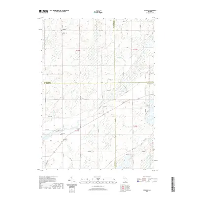
2019 Map of Leonidas
USGS Topo · Published 2019About this map
Leonidas and Fulton serve as the primary population centers in this rural landscape spanning the borders of Kalamazoo, St. Joseph, Calhoun, and Branch Counties. The southern portion of the area is defined by the winding course of the Saint Joseph River, which is fed by Nottawa Creek and Bear Cr. The region is characterized by numerous small lakes and basins, such as Marl Lake, Lehr Lake, and Oliverda Lake, suggesting a glaciated terrain with a high water table. Genealogists can locate several local burial grounds, including Leonidas Cem, Factoryville Cem, South Fulton Cem, and Blossom Cem. The settlement pattern follows a clear grid of section-line roads, such as Michigan Ave and Factoryville Rd, reflecting the agricultural heritage of the Michigan prairie and oak openings.
Find a feature on this map
50 named features on this map. Tap any name to fly to it.
Don’t see what you’re looking for? This feature index may not catch every label — zoom into the map to look around manually.
Map Details
Editions of this 2019 Leonidas Map
This is the sole edition of this map. No revisions or reprints were ever made.
Other maps of this area

1918 · Union City
USGS Topo · 1:62,500

1918 · Leonidas
USGS Topo · 1:62,500

1944 · Leonidas
USGS Topo · 1:62,500

1947 · Union City
USGS Topo · 1:62,500

1947 · Leonidas
USGS Topo · 1:62,500

1950 · Leonidas
USGS Topo · 1:62,500

1950 · Union City
USGS Topo · 1:62,500

1953 · Fort Wayne
USGS Topo · 1:250,000

1956 · Fort Wayne
USGS Topo · 1:250,000

1958 · Grand Rapids
USGS Topo · 1:250,000