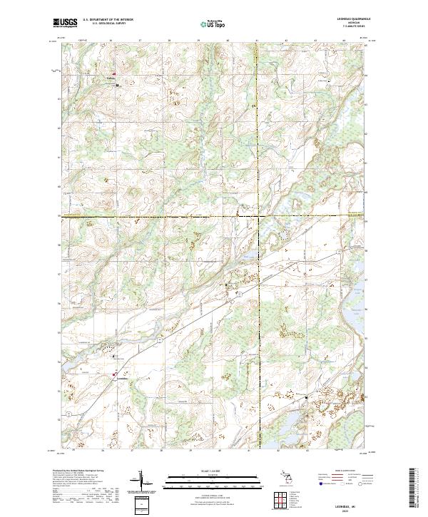
2023 Map of Leonidas
USGS Topo · Published 2023About this map
Leonidas and Fulton anchor this modern-era study of the rural intersection where Kalamazoo, St. Joseph, Calhoun, and Branch counties meet. The landscape is defined by the winding course of the Saint Joseph River in the south and the intricate drainage of Nottawa Creek and Bear Creek. For genealogists, the map provides precise locations for several burial grounds, including the Indian Cem north of the county line and the Factoryville Cem situated along Mendon Road. The region's low-lying nature is evident in the numerous small water bodies like Marl Lake, Mud Lake, and Oliverda Lake that dot the central and eastern portions of the quadrangle. These wetlands and creeks, including the channelized Snyder and Snyder Drain, suggest a history of careful water management to support the agriculture-dominated terrain that connects these small Michigan communities.
Find a feature on this map
72 named features on this map. Tap any name to fly to it.
Don’t see what you’re looking for? This feature index may not catch every label — zoom into the map to look around manually.
Map Details
Editions of this 2023 Leonidas Map
This is the sole edition of this map. No revisions or reprints were ever made.
Other maps of this area

1918 · Union City
USGS Topo · 1:62,500

1918 · Leonidas
USGS Topo · 1:62,500

1944 · Leonidas
USGS Topo · 1:62,500

1947 · Union City
USGS Topo · 1:62,500

1947 · Leonidas
USGS Topo · 1:62,500

1950 · Leonidas
USGS Topo · 1:62,500

1950 · Union City
USGS Topo · 1:62,500

1953 · Fort Wayne
USGS Topo · 1:250,000

1956 · Fort Wayne
USGS Topo · 1:250,000

1958 · Grand Rapids
USGS Topo · 1:250,000