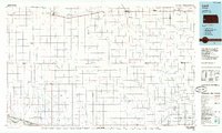
1985 Map of Leoti
USGS Topo · Published 1985About this map
Missouri Pacific railroad lines anchor the high plains landscape of western Kansas, connecting a string of agricultural rail towns including Tribune, Selkirk, and Leoti. This 1985 survey captures the region's methodical grid of section lines and the complex network of intermittent drainage channels such as White Woman Creek and Mattox Draw that carve through the prairie. In the southwest corner, the Arkansas River cuts across the terrain near Coolidge, accompanied by the Atchison Topeka and Santa Fe rail corridor.
Find a feature on this map
44 named features on this map. Tap any name to fly to it.
Don’t see what you’re looking for? This feature index may not catch every label — zoom into the map to look around manually.
Map Details
Editions of this 1985 Leoti Map
This is the sole edition of this map. No revisions or reprints were ever made.
Other maps of this area

1890 · Granada
USGS Topo · 1:125,000

1891 · Albany
USGS Topo · 1:125,000

1891 · Larned
USGS Topo · 1:125,000

1892 · Cheyenne Wells
USGS Topo · 1:125,000

1892 · Granada
USGS Topo · 1:125,000

1893 · Albany
USGS Topo · 1:125,000

1894 · Cheyenne Wells
USGS Topo · 1:125,000

1894 · Granada
USGS Topo · 1:125,000

1896 · Garden
USGS Topo · 1:125,000

1900 · Syracuse
USGS Topo · 1:125,000