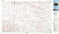
1987 Map of Leoti
USGS Topo · Published 1988About this map
Leoti and Tribune serve as the primary hubs for this Western Kansas landscape, which is defined by a dense grid of section lines and the linear paths of the Pacific Union and Atchison Topeka and Santa Fe railroads. The map captures the agricultural and industrial character of the High Plains in the late 20th century, notably detailing a significant Gas Field in the southern portion of the region.
Find a feature on this map
59 named features on this map. Tap any name to fly to it.
Don’t see what you’re looking for? This feature index may not catch every label — zoom into the map to look around manually.
Map Details
Editions of this 1987 Leoti Map
This is the sole edition of this map. No revisions or reprints were ever made.
Other maps of this area

1890 · Granada
USGS Topo · 1:125,000

1891 · Albany
USGS Topo · 1:125,000

1891 · Larned
USGS Topo · 1:125,000

1892 · Cheyenne Wells
USGS Topo · 1:125,000

1892 · Granada
USGS Topo · 1:125,000

1893 · Albany
USGS Topo · 1:125,000

1894 · Cheyenne Wells
USGS Topo · 1:125,000

1894 · Granada
USGS Topo · 1:125,000

1896 · Garden
USGS Topo · 1:125,000

1900 · Syracuse
USGS Topo · 1:125,000