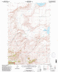
1995 Map of Lepleys Creek
USGS Topo · Published 1997About this map
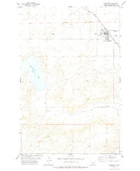
The Highwood Mountains dominate this 1990s landscape in Chouteau County, where the transition from high peaks to the plains is marked by a complex network of drainage and isolated lakes. This area includes a significant portion of the Lewis and Clark National Forest and the Judith Ranger District Nat For, representing a preserved environment of deep gulches and ridgelines. Water is the primary defining feature of the local geography, from the sizable Big Lake and Kingsbury Lake to the meandering courses of Lepleys Creek and Alder Creek. The map documents subtle signs of human activity and land management, such as Storage Bins and a singular Grave, set against the backdrop of the 8th Standard Parallel North. The presence of numerous unnamed Springs throughout the foothills suggests a landscape where water sources were critical for the development of local grazing and ranching operations.
Find a feature on this map
16 named features on this map. Tap any name to fly to it.
Don’t see what you’re looking for? This feature index may not catch every label — zoom into the map to look around manually.
Map Details
Editions of this 1995 Lepleys Creek Map
This is the sole edition of this map. No revisions or reprints were ever made.
Other maps of this area

1890 · Fort Benton
USGS Topo · 1:250,000

1892 · Fort Benton
USGS Topo · 1:250,000

1897 · Fort Benton
USGS Topo · 1:250,000

1954 · Great Falls
USGS Topo · 1:250,000

1957 · Great Falls
USGS Topo · 1:250,000
1972 · Montague
USGS Topo · 1:24,000
1972 · Shonkin
USGS Topo · 1:24,000
1972 · Geraldine NE
USGS Topo · 1:24,000

1978 · Arrow Peak
USGS Topo · 1:24,000
1978 · Geraldine
USGS Topo · 1:24,000