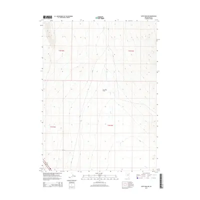
2015 Map of Leppy Peak NW
USGS Topo · Published 2015About this map
Pilot Creek Valley dominates this high-desert landscape in Elko County, where the subtle drainage of Pilot Cr defines the basin's floor. The 2015 survey illustrates a sparsely developed region of Nevada's interior, marked primarily by long stretches of unpaved access routes like Cr-767 and Spenby Ln. A single water source, Small Spring, is noted in the northern reaches, indicating the vital importance of dependable springs in this arid terrain. The township and range divisions, including t36n r69e and t35n r68e, provide the primary structure for land management in this vast open country, where ranching and resource access are facilitated by these basic road networks.
Find a feature on this map
10 named features on this map. Tap any name to fly to it.
Don’t see what you’re looking for? This feature index may not catch every label — zoom into the map to look around manually.
Map Details
Editions of this 2015 Leppy Peak NW Map
This is the sole edition of this map. No revisions or reprints were ever made.
Other maps of this area

1955 · Wells
USGS Topo · 1:250,000

1955 · Elko
USGS Topo · 1:250,000

1958 · Wells
USGS Topo · 1:250,000

1958 · Elko
USGS Topo · 1:250,000

1961 · Wells
USGS Topo · 1:250,000

1962 · Elko
USGS Topo · 1:250,000

1965 · Elko
USGS Topo · 1:250,000

1967 · Pilot Peak
USGS Topo · 1:24,000
1967 · Pilot Peak SW
USGS Topo · 1:24,000

1967 · Cobre SE
USGS Topo · 1:24,000