
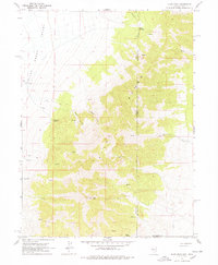
1967 Map of Pilot Peak
USGS Topo · Published 1971About this map
The high desert terrain of the Pilot Range dominates this mid-century topographic record, punctuated by the towering summit of Pilot Peak. The landscape is defined by its extreme isolation and the critical presence of water, as evidenced by numerous scattered Spring and Springs labels across the mountain slopes. In the lower elevations of the Pilot Creek Valley, the Bar O Ranch stands as a rare sign of human habitation, supported by a system of Wells. The map traces the border between Nevada and Utah, showing how the topography transitions from the steep drainages of Horse Canyon and Debbs Canyon into the flatter basins. The inclusion of an Aqueduct crossing the valley floor indicates the intensive management of resources required to sustain ranching and infrastructure in this arid corridor of Elko County.
Find a feature on this map
15 named features on this map. Tap any name to fly to it.
Don’t see what you’re looking for? This feature index may not catch every label — zoom into the map to look around manually.
Map Details
Editions of this 1967 Pilot Peak Map
2 editions found
Other maps of this area

1953 · Tooele
USGS Topo · 1:250,000

1954 · Brigham City
USGS Topo · 1:250,000

1955 · Tooele
USGS Topo · 1:250,000

1955 · Wells
USGS Topo · 1:250,000

1955 · Elko
USGS Topo · 1:250,000

1958 · Wells
USGS Topo · 1:250,000

1958 · Elko
USGS Topo · 1:250,000

1958 · Brigham City
USGS Topo · 1:250,000

1961 · Wells
USGS Topo · 1:250,000

1962 · Elko
USGS Topo · 1:250,000