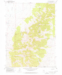
1967 Map of Pilot Peak
USGS Topo · Published 1978About this map
Pilot Peak dominates the high-altitude terrain along the state line in the late 1960s, serving as a prominent landmark for the transition between the Pilot Creek Valley and the Pilot Range. This survey details a sparsely settled high-desert landscape where water sources are the primary points of interest for livestock and travel. Numerous water points like McCaislion Springs, Cove Springs, and Wilton Spring are critical features, as is the presence of an aqueduct and a well at lower elevations. The map reveals the ranching footprint of the era through the Bar O Ranch and a network of jeep trails navigating rugged corridors such as Horse Canyon and Debbs Canyon. The boundary between Elko and Box Elder counties is clearly delineated as it traverses the mountainous divide between Nevada and Utah.
Find a feature on this map
23 named features on this map. Tap any name to fly to it.
Don’t see what you’re looking for? This feature index may not catch every label — zoom into the map to look around manually.
Map Details
Editions of this 1967 Pilot Peak Map
2 editions found

Other maps of this area

1953 · Tooele
USGS Topo · 1:250,000

1954 · Brigham City
USGS Topo · 1:250,000

1955 · Tooele
USGS Topo · 1:250,000

1955 · Wells
USGS Topo · 1:250,000

1955 · Elko
USGS Topo · 1:250,000

1958 · Wells
USGS Topo · 1:250,000

1958 · Elko
USGS Topo · 1:250,000

1958 · Brigham City
USGS Topo · 1:250,000

1961 · Wells
USGS Topo · 1:250,000

1962 · Elko
USGS Topo · 1:250,000