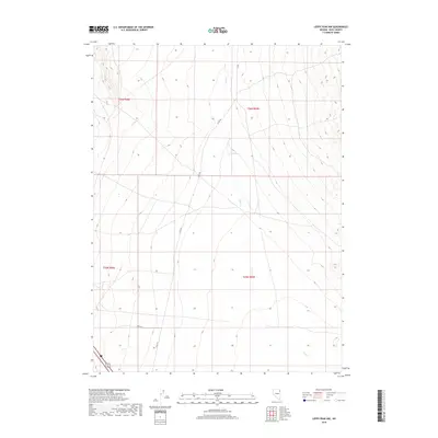
2018 Map of Leppy Peak NW
USGS Topo · Published 2018About this map
Pilot Rd and Co Rd traverse this high-desert region of Elko County, marking the primary human imprint on an otherwise arid landscape. This 2018 survey documents the intricate water drainage of Pilot Cr, which flows southward through the eastern half of the map. A critical water source for local history and ranching is identified at Small Spring, situated near the center of the quadrangle. The map is organized by the Public Land Survey System, showing the intersections of t36n r68e, t36n r69e, t35n r68e, and t35n r69e. While much of the terrain is defined by its wide, sloping contours, smaller developments like Spendy Ln in the southwest corner indicate modern residential or ranching encroachment into this vast basin area.
Find a feature on this map
9 named features on this map. Tap any name to fly to it.
Don’t see what you’re looking for? This feature index may not catch every label — zoom into the map to look around manually.
Map Details
Editions of this 2018 Leppy Peak NW Map
This is the sole edition of this map. No revisions or reprints were ever made.
Other maps of this area

1955 · Wells
USGS Topo · 1:250,000

1955 · Elko
USGS Topo · 1:250,000

1958 · Wells
USGS Topo · 1:250,000

1958 · Elko
USGS Topo · 1:250,000

1961 · Wells
USGS Topo · 1:250,000

1962 · Elko
USGS Topo · 1:250,000

1965 · Elko
USGS Topo · 1:250,000

1967 · Pilot Peak
USGS Topo · 1:24,000
1967 · Pilot Peak SW
USGS Topo · 1:24,000

1967 · Cobre SE
USGS Topo · 1:24,000