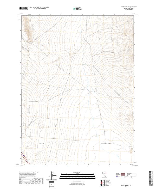
2021 Map of Leppy Peak NW
USGS Topo · Published 2021About this map
Pilot Cr defines the drainage pattern across this arid high-desert landscape in Elko County, tracing a path through the eastern sagebrush terrain. The map captures the remote infrastructure of the Great Basin, where the primary transport corridor follows Pilot Rd as it cuts across the township lines of t36n r69e and t35n r69e. Local water sources are critical markers in this environment, represented here by the isolated Small Spring. To the south, Spendy Ln provides access to the flatter basin floor, illustrating the sparse but deliberate layout of rural Nevada road networks. This topographic record documents the area just prior to 2021, showing the intersection of section-line boundaries and the subtle natural hydrology of the Pilot Creek watershed.
Find a feature on this map
8 named features on this map. Tap any name to fly to it.
Don’t see what you’re looking for? This feature index may not catch every label — zoom into the map to look around manually.
Map Details
Editions of this 2021 Leppy Peak NW Map
This is the sole edition of this map. No revisions or reprints were ever made.
Other maps of this area

1955 · Wells
USGS Topo · 1:250,000

1955 · Elko
USGS Topo · 1:250,000

1958 · Wells
USGS Topo · 1:250,000

1958 · Elko
USGS Topo · 1:250,000

1961 · Wells
USGS Topo · 1:250,000

1962 · Elko
USGS Topo · 1:250,000

1965 · Elko
USGS Topo · 1:250,000

1967 · Pilot Peak
USGS Topo · 1:24,000
1967 · Pilot Peak SW
USGS Topo · 1:24,000

1967 · Cobre SE
USGS Topo · 1:24,000