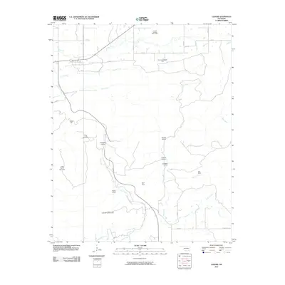
2010 Map of Lequire
USGS Topo · Published 2010About this map
Little Yancy Mountain and Long Mountain dominate this part of Oklahoma, where the landscape is defined by a dense network of ridges and drainages. The topography is marked by a series of deep recesses such as Huckleberry Hollow and Askew Hollow, which funnel runoff into Rock Creek and Turkey Creek. This 2010 survey illustrates a rural interior where infrastructure is largely confined to secondary routes like E1315 Rd and N4485 Rd, connecting the scattered lowlands of Turkey Flat to the higher elevations of Ryan Peak. Water management is evident in the north with structures such as Cowden Laterals Site 12 Dam and the Oknoname 361001 Dam, indicating the region's reliance on managed reservoirs for agricultural or conservation purposes.
Find a feature on this map
35 named features on this map. Tap any name to fly to it.
Don’t see what you’re looking for? This feature index may not catch every label — zoom into the map to look around manually.
Map Details
Editions of this 2010 Lequire Map
This is the sole edition of this map. No revisions or reprints were ever made.
Other maps of this area

1900 · Sansbois
USGS Topo · 1:125,000

1900 · Sallisaw
USGS Topo · 1:125,000

1900 · Winding Stair
USGS Topo · 1:125,000

1901 · Tuskahoma
USGS Topo · 1:125,000

1908 · Tuskahoma
USGS Topo · 1:125,000

1909 · Tuskahoma
USGS Topo · 1:125,000

1909 · Winding Stair
USGS Topo · 1:125,000

1909 · Sans Bois
USGS Topo · 1:125,000

1911 · Sallisaw
USGS Topo · 1:125,000

1911 · Sansbois
USGS Topo · 1:125,000