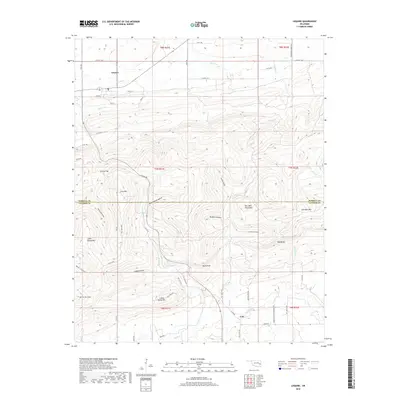
2018 Map of Lequire
USGS Topo · Published 2018About this map
Lequire and Lodi anchor the northern and southern reaches of this landscape where the Sans Bois Mountains dominate the terrain. The topography is defined by a series of steep ridges and secluded valleys, with named peaks like Long Mtn, Little Yancy Mtn, and Ryan Peak rising above the watershed. Drainage follows a complex network of creeks including Turkey Cr, Andrew Cr, and Bear Cr, which carve through deep depressions such as Huckleberry Hollow and Buzzard Hollow.
Find a feature on this map
59 named features on this map. Tap any name to fly to it.
Don’t see what you’re looking for? This feature index may not catch every label — zoom into the map to look around manually.
Map Details
Editions of this 2018 Lequire Map
This is the sole edition of this map. No revisions or reprints were ever made.
Other maps of this area

1900 · Sansbois
USGS Topo · 1:125,000

1900 · Sallisaw
USGS Topo · 1:125,000

1900 · Winding Stair
USGS Topo · 1:125,000

1901 · Tuskahoma
USGS Topo · 1:125,000

1908 · Tuskahoma
USGS Topo · 1:125,000

1909 · Tuskahoma
USGS Topo · 1:125,000

1909 · Winding Stair
USGS Topo · 1:125,000

1909 · Sans Bois
USGS Topo · 1:125,000

1911 · Sallisaw
USGS Topo · 1:125,000

1911 · Sansbois
USGS Topo · 1:125,000