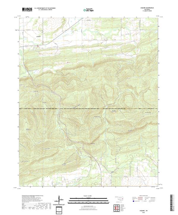
2022 Map of Lequire
USGS Topo · Published 2022About this map
Lequire sits at the northern edge of this high-relief landscape where the valley of Turkey Cr meets the rising elevations of the Sans Bois Mountains. The topography is defined by a series of parallel ridges and deeply cut hollows, including Buzzard Hollow and Huckleberry Hollow, which dictated the early settlement patterns and road placements between Haskell and Latimer counties. To the south, the terrain climbs toward prominent landmarks such as Ryan Peak and Little Yancy Mtn, while the community of Lodi anchors the southern drainage near Bear Cr. The map reveals how the local economy and movement were restricted by the natural barriers of the mountains, with roads like Main St and Valley St in Lequire following the narrow level ground of Turkey Flat before giving way to winding mountain routes like D1345 Rd.
Find a feature on this map
62 named features on this map. Tap any name to fly to it.
Don’t see what you’re looking for? This feature index may not catch every label — zoom into the map to look around manually.
Map Details
Editions of this 2022 Lequire Map
This is the sole edition of this map. No revisions or reprints were ever made.
Other maps of this area

1900 · Sansbois
USGS Topo · 1:125,000

1900 · Sallisaw
USGS Topo · 1:125,000

1900 · Winding Stair
USGS Topo · 1:125,000

1901 · Tuskahoma
USGS Topo · 1:125,000

1908 · Tuskahoma
USGS Topo · 1:125,000

1909 · Tuskahoma
USGS Topo · 1:125,000

1909 · Winding Stair
USGS Topo · 1:125,000

1909 · Sans Bois
USGS Topo · 1:125,000

1911 · Sallisaw
USGS Topo · 1:125,000

1911 · Sansbois
USGS Topo · 1:125,000