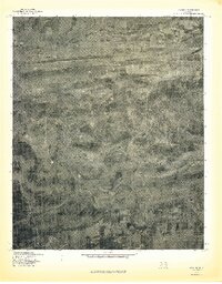
1977 Map of Lequire
USGS Topo · Published 1977About this map
Lequire and the surrounding Haskell County landscape are presented in high detail through this 1977 orthophotoquad, which uses aerial photography to capture the literal state of the land. The topography is dominated by the ridges of the Sans Bois Mountains, where the elevation rises significantly at Ryan Peak and Little Yancy Mountain. These highlands dictate the local drainage patterns, sending water through Bear Creek and the Mountain Fk as they carve through the timbered slopes.
Find a feature on this map
7 named features on this map. Tap any name to fly to it.
Don’t see what you’re looking for? This feature index may not catch every label — zoom into the map to look around manually.
Map Details
Editions of this 1977 Lequire Map
This is the sole edition of this map. No revisions or reprints were ever made.
Other maps of this area

1900 · Sansbois
USGS Topo · 1:125,000

1900 · Sallisaw
USGS Topo · 1:125,000

1900 · Winding Stair
USGS Topo · 1:125,000

1901 · Tuskahoma
USGS Topo · 1:125,000

1908 · Tuskahoma
USGS Topo · 1:125,000

1909 · Tuskahoma
USGS Topo · 1:125,000

1909 · Winding Stair
USGS Topo · 1:125,000

1909 · Sans Bois
USGS Topo · 1:125,000

1911 · Sallisaw
USGS Topo · 1:125,000

1911 · Sansbois
USGS Topo · 1:125,000