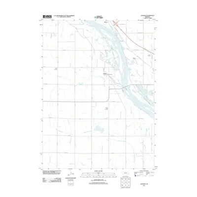
2011 Map of Leshara
USGS Topo · Published 2011About this map
The Platte River valley defines the eastern landscape of this Nebraska region, where braided channels and islands create a complex riparian environment. Along its western banks, the small settlement of Leshara serves as a focal point, anchored by the Leshara Post Office. The topography is shaped by a network of drainage systems including Otoe Creek, Upper Clear Creek, and Clear Creek, which traverse the agricultural sections and section-line roads like Co Road T.
Find a feature on this map
39 named features on this map. Tap any name to fly to it.
Don’t see what you’re looking for? This feature index may not catch every label — zoom into the map to look around manually.
Map Details
Editions of this 2011 Leshara Map
This is the sole edition of this map. No revisions or reprints were ever made.
Other maps of this area

1893 · Fremont
USGS Topo · 1:125,000

1896 · Fremont
USGS Topo · 1:125,000

1899 · Wahoo
USGS Topo · 1:125,000

1955 · Fremont
USGS Topo · 1:250,000

1957 · Fremont
USGS Topo · 1:250,000

1958 · Fremont
USGS Topo · 1:250,000

1968 · Valley
USGS Topo · 1:24,000

1968 · Leshara
USGS Topo · 1:24,000
1968 · Fremont West
USGS Topo · 1:24,000

1968 · Fremont East
USGS Topo · 1:24,000