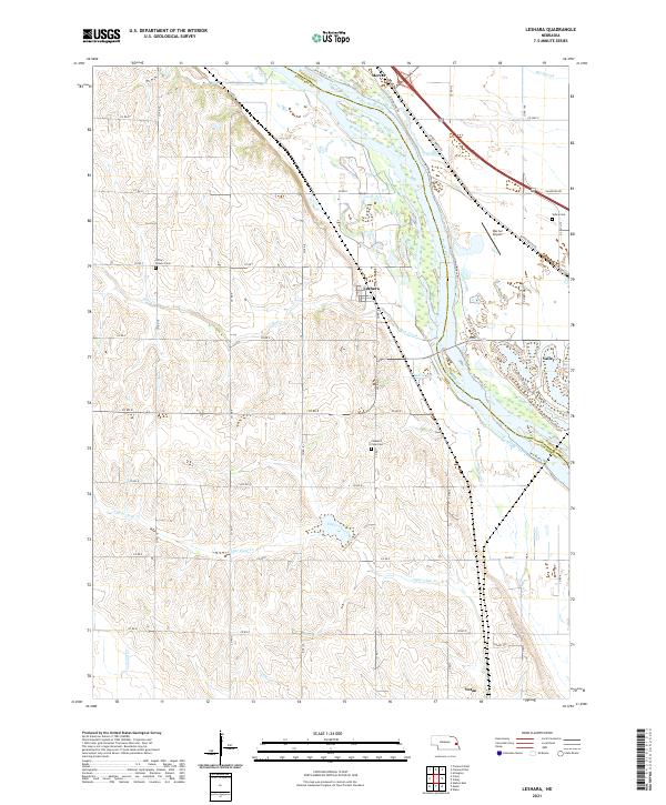
2021 Map of Leshara
USGS Topo · Published 2021About this map
The Platte River corridor defines the geography of this Nebraska landscape, where the braided river channel serves as the natural boundary between Saunders and Douglas counties. The village of Leshara sits centrally on the western bank, surrounded by a grid of rural roads such as Co RD 7 and Co RD S. This area reveals a pattern of early prairie settlement and subsequent agricultural stability, evidenced by local landmarks like Little Flower Cem and Pleasant View Cem. To the east, the town of Valley and the Werner Airport represent more concentrated development near the river bend. The terrain is marked by numerous drainage systems including Otoe Creek, Upper Clear Creek, and Big Slough, illustrating the complex hydrology of the river bottomlands. Further south, the settlement of Yutan marks the lower reaches of the survey, connected by a network of county highways and local routes.
Find a feature on this map
47 named features on this map. Tap any name to fly to it.
Don’t see what you’re looking for? This feature index may not catch every label — zoom into the map to look around manually.
Map Details
Editions of this 2021 Leshara Map
This is the sole edition of this map. No revisions or reprints were ever made.
Other maps of this area

1893 · Fremont
USGS Topo · 1:125,000

1896 · Fremont
USGS Topo · 1:125,000

1899 · Wahoo
USGS Topo · 1:125,000

1955 · Fremont
USGS Topo · 1:250,000

1957 · Fremont
USGS Topo · 1:250,000

1958 · Fremont
USGS Topo · 1:250,000

1968 · Valley
USGS Topo · 1:24,000

1968 · Leshara
USGS Topo · 1:24,000
1968 · Fremont West
USGS Topo · 1:24,000

1968 · Fremont East
USGS Topo · 1:24,000