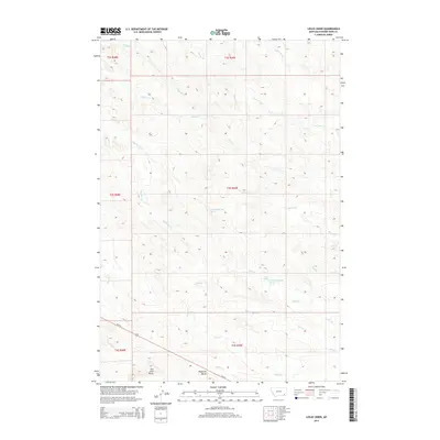
2014 Map of Leslie Creek
USGS Topo · Published 2014About this map
Haystack Butte and Two Tree Butte anchor the southern landscape of this Powder River County region, rising above a complex network of drainage basins. The area is defined by its numerous named watercourses, including Leslie Cr, Middle Cr, and Third Cr, which carve through the terrain as part of the local watershed. This 2014 survey documents the hydrography in detail, identifying specific water sources such as Leslie Spring and numbered technical markers like 03S49E21BCCB01 Spring. The primary artery for travel through this rural Montana expanse is Us-212, which cuts diagonally across the southwestern corner, connecting the remote drainage of Wiser Cr and Sixmile Cr to the wider region. The map provides a look at the township and range divisions that still dictate the rural land use and navigation of the high plains.
Find a feature on this map
26 named features on this map. Tap any name to fly to it.
Don’t see what you’re looking for? This feature index may not catch every label — zoom into the map to look around manually.
Map Details
Editions of this 2014 Leslie Creek Map
This is the sole edition of this map. No revisions or reprints were ever made.
Other maps of this area

1954 · Ekalaka
USGS Topo · 1:250,000

1956 · Ekalaka
USGS Topo · 1:250,000

1958 · Ekalaka
USGS Topo · 1:250,000

1965 · Ekalaka
USGS Topo · 1:250,000

1966 · Sonnette
USGS Topo · 1:24,000

1966 · Elk Ridge
USGS Topo · 1:24,000

1966 · Samuelson Ranch
USGS Topo · 1:24,000

1973 · Olive
USGS Topo · 1:24,000

1973 · Box Elder Creek
USGS Topo · 1:24,000

1973 · Coalwood
USGS Topo · 1:24,000