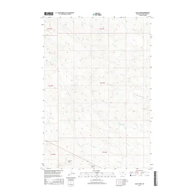
2017 Map of Leslie Creek
USGS Topo · Published 2017About this map
Haystack Butte and Two Tree Butte rise as the most prominent topographic landmarks in this portion of Powder River County, overseeing a landscape carved by a network of seasonal drainages. During the mid-2010s, this area remained largely defined by its natural hydrology, with Leslie Creek and its associated Leslie Spring serving as focal points for the local drainage basin. The map illustrates a complex system of creek forks, including the North Fork and South Fork of Ash Creek, which underscore the importance of water management and topography in Montana's ranching country. Transportation is primarily limited to rugged paths like those following Road Creek and Wiser Creek, reflecting the sparse settlement patterns and vast land divisions typical of the Western public land survey system seen here in townships like t3s r49e.
Find a feature on this map
25 named features on this map. Tap any name to fly to it.
Don’t see what you’re looking for? This feature index may not catch every label — zoom into the map to look around manually.
Map Details
Editions of this 2017 Leslie Creek Map
This is the sole edition of this map. No revisions or reprints were ever made.
Other maps of this area

1954 · Ekalaka
USGS Topo · 1:250,000

1956 · Ekalaka
USGS Topo · 1:250,000

1958 · Ekalaka
USGS Topo · 1:250,000

1965 · Ekalaka
USGS Topo · 1:250,000

1966 · Sonnette
USGS Topo · 1:24,000

1966 · Elk Ridge
USGS Topo · 1:24,000

1966 · Samuelson Ranch
USGS Topo · 1:24,000

1973 · Olive
USGS Topo · 1:24,000

1973 · Box Elder Creek
USGS Topo · 1:24,000

1973 · Coalwood
USGS Topo · 1:24,000