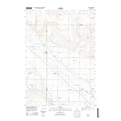
2013 Map of Letha
USGS Topo · Published 2013About this map
The Payette River anchors this Idaho landscape, carving through the Lower Payette Valley and defining the agricultural character of the region. A sophisticated network of early 21st-century irrigation infrastructure is evident, with the Emmett Irrigation District N Side Main Canal and the Farmers Cooperative Canal delivering water to the surrounding benchlands. These systems allow for cultivation in the Emmett Bench and Emmett Valley, transforming the arid terrain into productive acreage.
Find a feature on this map
67 named features on this map. Tap any name to fly to it.
Don’t see what you’re looking for? This feature index may not catch every label — zoom into the map to look around manually.
Map Details
Editions of this 2013 Letha Map
This is the sole edition of this map. No revisions or reprints were ever made.
Other maps of this area

1897 · Weiser
USGS Topo · 1:125,000

1898 · Nampa
USGS Topo · 1:125,000

1952 · Birding Island
USGS Topo · 1:24,000

1955 · Baker
USGS Topo · 1:250,000

1955 · Boise
USGS Topo · 1:250,000

1958 · Boise
USGS Topo · 1:250,000

1959 · Baker
USGS Topo · 1:250,000

1962 · Boise
USGS Topo · 1:250,000
1965 · New Plymouth
USGS Topo · 1:24,000
1965 · Parma SE
USGS Topo · 1:24,000