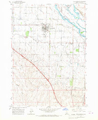
1965 Map of New Plymouth
USGS Topo · Published 1967About this map
New Plymouth serves as the central hub of this agricultural landscape in the mid-1960s, its unique horseshoe-shaped street layout clearly visible south of the Union Pacific railroad line. The town's civic character is defined by the New Plymouth Sch and the adjacent County Fairgrounds, while the surrounding Lower Payette Valley is defined by a complex network of irrigation and transportation. To the north, the Payette River meanders past Birding Island and The Bluffs, while the southern terrain transitions into a more dissected landscape marked by Langley Gulch and Ashlock Gulch. This survey documents a period of established rural infrastructure, noting local landmarks like Hamilton Corner and cemeteries such as Parkview Cem and Kennedy Cem that anchor the community's genealogy.
Find a feature on this map
31 named features on this map. Tap any name to fly to it.
Don’t see what you’re looking for? This feature index may not catch every label — zoom into the map to look around manually.
Map Details
Editions of this 1965 New Plymouth Map
2 editions found
Other maps of this area

1897 · Weiser
USGS Topo · 1:125,000

1898 · Nampa
USGS Topo · 1:125,000

1951 · Payette
USGS Topo · 1:24,000

1952 · Birding Island
USGS Topo · 1:24,000

1955 · Baker
USGS Topo · 1:250,000

1955 · Boise
USGS Topo · 1:250,000

1958 · Boise
USGS Topo · 1:250,000

1959 · Baker
USGS Topo · 1:250,000

1962 · Boise
USGS Topo · 1:250,000
1965 · Nyssa
USGS Topo · 1:24,000