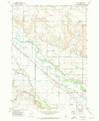
1971 Map of Letha
USGS Topo · Published 1973About this map
The Payette River carves through the Lower Payette Valley, defining a landscape heavily modified by early 1970s irrigation systems. This network of water management is anchored by the Emmett Irrigation District Canal and the Farmers Cooperative Canal, which feed the agricultural plots of the Emmett Bench. The Union Pacific railroad corridor parallels the river, connecting the small settlement of Letha and the nearby Little Rock to the wider region. Family-named infrastructure and landmarks provide a detailed look at local development, including Falk Bridge and Church Road. Educational and community centers are represented by Cooper School and Hanna Sch, while the presence of the Falk Cem and numerous named gulches like Graveyard Gulch offer clear markers for those researching the genealogy and geographic history of Gem and Payette Counties.
Find a feature on this map
48 named features on this map. Tap any name to fly to it.
Don’t see what you’re looking for? This feature index may not catch every label — zoom into the map to look around manually.
Map Details
Editions of this 1971 Letha Map
This is the sole edition of this map. No revisions or reprints were ever made.
Other maps of this area

1897 · Weiser
USGS Topo · 1:125,000

1898 · Nampa
USGS Topo · 1:125,000

1952 · Birding Island
USGS Topo · 1:24,000

1955 · Baker
USGS Topo · 1:250,000

1955 · Boise
USGS Topo · 1:250,000

1958 · Boise
USGS Topo · 1:250,000

1959 · Baker
USGS Topo · 1:250,000

1962 · Boise
USGS Topo · 1:250,000
1965 · New Plymouth
USGS Topo · 1:24,000
1965 · Parma SE
USGS Topo · 1:24,000