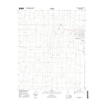
2016 Map of Levelland West
USGS Topo · Published 2016About this map
Levelland occupies the northeastern portion of this High Plains landscape, where the town's street grid meets an expansive network of rural roads defined by the region's energy and agricultural heritage. The industrial character of the area is explicitly preserved in the local nomenclature, with thoroughfares such as Ironman Rd, Gusher Rd, Black Gold Rd, and Drill Stem tracing the infrastructure of the Permian Basin's oil and gas economy. These roads divide the terrain into a meticulous rectangular grid, typical of the Llano Estacado's development. Within the town limits, the Levelland Municipal Airport and Lobo Lake serve as primary landmarks, while the Levelland Municipal Cem and Hockley County Cem offer significant points of interest for genealogists. The map also reveals secondary routes like Buckboard and Maverick Rd, reflecting the ranching roots that preceded the twentieth-century oil boom.
Find a feature on this map
46 named features on this map. Tap any name to fly to it.
Don’t see what you’re looking for? This feature index may not catch every label — zoom into the map to look around manually.
Map Details
Editions of this 2016 Levelland West Map
This is the sole edition of this map. No revisions or reprints were ever made.
Other maps of this area

1954 · Brownfield
USGS Topo · 1:250,000

1958 · Brownfield
USGS Topo · 1:250,000

1962 · Brownfield
USGS Topo · 1:250,000

1964 · Whitharral
USGS Topo · 1:24,000

1965 · Levelland West
USGS Topo · 1:24,000

1965 · Sundown
USGS Topo · 1:24,000

1965 · Levelland East
USGS Topo · 1:24,000

1965 · Plains 1 NE
USGS Topo · 1:24,000

1965 · Hester Ranch
USGS Topo · 1:24,000

1965 · Pettit
USGS Topo · 1:24,000