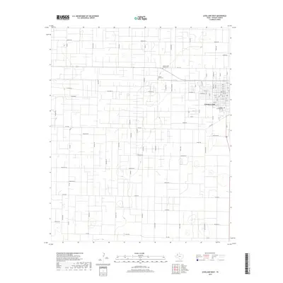
2019 Map of Levelland West
USGS Topo · Published 2019About this map
Levelland anchors the eastern edge of this High Plains landscape, where the town's residential grid meets an expansive network of rural roads and agricultural plots. The area's history is reflected in its local burial grounds, including the Hockley County Cem, the Hockley County Hispanic Cem, and the Levelland Municipal Cem, the latter situated near the community's southern edge. The map reveals a land structured by resource extraction and transit, evidenced by roads with names like Gusher Rd, Buckboard, and Five Mile Rd. Small depressions and playa lakes characteristic of this region are scattered across the terrain, with Lobo Lake serving as a distinct water feature near the heart of the settlement. To the north, thoroughfares such as N Fm 1490 and America Rd define the rural corridors extending into the surrounding county.
Find a feature on this map
78 named features on this map. Tap any name to fly to it.
Don’t see what you’re looking for? This feature index may not catch every label — zoom into the map to look around manually.
Map Details
Editions of this 2019 Levelland West Map
This is the sole edition of this map. No revisions or reprints were ever made.
Other maps of this area

1954 · Brownfield
USGS Topo · 1:250,000

1958 · Brownfield
USGS Topo · 1:250,000

1962 · Brownfield
USGS Topo · 1:250,000

1964 · Whitharral
USGS Topo · 1:24,000

1965 · Levelland West
USGS Topo · 1:24,000

1965 · Sundown
USGS Topo · 1:24,000

1965 · Levelland East
USGS Topo · 1:24,000

1965 · Plains 1 NE
USGS Topo · 1:24,000

1965 · Hester Ranch
USGS Topo · 1:24,000

1965 · Pettit
USGS Topo · 1:24,000