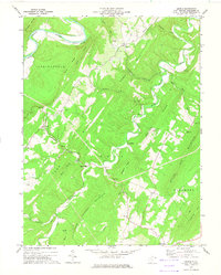
1973 Map of Levels
USGS Topo · Published 1975About this map
The Cacapon River and Little Cacapon River wind through the ridges of Hampshire County, defining a landscape of isolated agricultural communities and upland terrain in the early 1970s. The settlement at Levels serves as a central point, surrounded by family-named landmarks like Hoffman Hollow and Queens Ridge. Small rural nodes such as Points and Higginsville are connected by a network of unimproved roads and a jeep trail, reflecting the area's transition between river-valley farming and the steeper slopes of Spring Gap Mountain.
Find a feature on this map
41 named features on this map. Tap any name to fly to it.
Don’t see what you’re looking for? This feature index may not catch every label — zoom into the map to look around manually.
Map Details
Editions of this 1973 Levels Map
This is the sole edition of this map. No revisions or reprints were ever made.
Other maps of this area

1891 · Romney
USGS Topo · 1:125,000

1894 · Winchester
USGS Topo · 1:125,000

1898 · Paw Paw
USGS Topo · 1:62,500

1899 · Flintstone
USGS Topo · 1:62,500

1900 · Pawpaw
USGS Topo · 1:62,500

1900 · Flintstone
USGS Topo · 1:62,500

1910 · Paw Paw
USGS Topo · 1:62,500

1916 · Capon Bridge
USGS Topo · 1:62,500

1921 · Hanging Rock
USGS Topo · 1:48,000

1923 · Capon Bridge
USGS Topo · 1:62,500