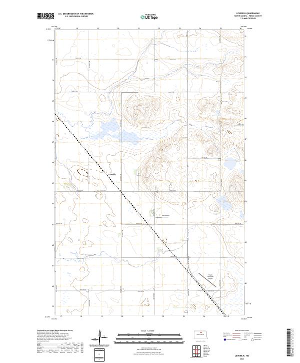
2024 Map of Leverich
USGS Topo · Published 2024About this map
Leverich sits at the heart of this Pierce County landscape, characterized by the expansive Pierce County Waterfowl Production Area. The terrain is defined by a grid of rural section roads, including 27th Ave NE and 70th St NE, which reflect the late-20th-century agricultural and conservation layout of North Dakota. Evidence of aviation history and local transit is present at both the Rugby Municipal Airport in the southeastern corner and the private Paul Airstrip situated further north. The map documents a sparsely populated prairie environment where wetland conservation is prioritized alongside traditional land divisions, providing a clear record of the intersection between municipal infrastructure and protected wildlife habitats in the early 21st century.
Find a feature on this map
22 named features on this map. Tap any name to fly to it.
Don’t see what you’re looking for? This feature index may not catch every label — zoom into the map to look around manually.
Map Details
Editions of this 2024 Leverich Map
This is the sole edition of this map. No revisions or reprints were ever made.
Other maps of this area

1953 · Devils Lake
USGS Topo · 1:250,000

1954 · Tunbridge
USGS Topo · 1:24,000

1954 · Overly SE
USGS Topo · 1:24,000

1954 · Barton
USGS Topo · 1:24,000

1954 · Berwick
USGS Topo · 1:24,000

1954 · Round Lake
USGS Topo · 1:24,000

1954 · Rugby NW
USGS Topo · 1:24,000

1954 · Leverich
USGS Topo · 1:24,000

1954 · Minot
USGS Topo · 1:250,000

1955 · Rugby
USGS Topo · 1:24,000