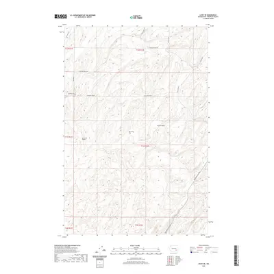
2020 Map of Levey NE
USGS Topo · Published 2020About this map
Rye Grass Coulee and the adjacent Rye Grass Flat define the topography of this Franklin County landscape, where the land falls away into the deep drainage of McCoy Canyon. The map reveals a highly structured section-line road network typical of the Columbia Basin's agricultural development, including Haverland Koontz Rd and E Blackman Ridge Rd. This 2020 survey illustrates how modern infrastructure like the Pasco Kahlotus Road follows the natural contours of the terrain. The presence of numerous family-named routes, such as Smith Canyon Rd, Gertler Rd, and Moulton Rd, provides a valuable geographic reference for local historians tracing the distribution of land and the evolution of rural access in the region.
Find a feature on this map
17 named features on this map. Tap any name to fly to it.
Don’t see what you’re looking for? This feature index may not catch every label — zoom into the map to look around manually.
Map Details
Editions of this 2020 Levey NE Map
This is the sole edition of this map. No revisions or reprints were ever made.
Other maps of this area

1915 · Wallulah
USGS Topo · 1:96,000

1916 · Connell
USGS Topo · 1:125,000

1918 · Connell
USGS Topo · 1:125,000

1918 · Wallula
USGS Topo · 1:125,000

1953 · Walla Walla
USGS Topo · 1:250,000

1958 · Walla Walla
USGS Topo · 1:250,000

1963 · Rye Grass Coulee
USGS Topo · 1:24,000

1964 · Levey SW
USGS Topo · 1:24,000

1964 · Levey SE
USGS Topo · 1:24,000

1964 · Levey NE
USGS Topo · 1:24,000