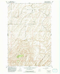
1991 Map of Levey NE
USGS Topo · Published 1992About this map
The Juniper Dunes Wilderness dominates the southwestern corner of this landscape, where shifting sands meet the agricultural corridors of Franklin County. Surveyed by the U.S. Geological Survey in the early 1990s, the map reveals a transition from the protected dunes to the managed lands of Rye Grass Flat. The Snake River carves through the northeast, its path followed by the Snake River Road. This area is characterized by an extensive network of rural infrastructure, including Haverland Koontz Road and several pipelines that traverse the coulees. Named topographic features like East Blackman Ridge and Rye Grass Coulee define the drainage patterns leading toward the river. Scattered agricultural outposts are evidenced by a corral, various water tanks, and storage bins near Hockett Lane, marking the persistent human footprint on this semi-arid terrain.
Find a feature on this map
25 named features on this map. Tap any name to fly to it.
Don’t see what you’re looking for? This feature index may not catch every label — zoom into the map to look around manually.
Map Details
Editions of this 1991 Levey NE Map
This is the sole edition of this map. No revisions or reprints were ever made.
Other maps of this area

1915 · Wallulah
USGS Topo · 1:96,000

1916 · Connell
USGS Topo · 1:125,000

1918 · Connell
USGS Topo · 1:125,000

1918 · Wallula
USGS Topo · 1:125,000

1953 · Walla Walla
USGS Topo · 1:250,000

1958 · Walla Walla
USGS Topo · 1:250,000

1963 · Rye Grass Coulee
USGS Topo · 1:24,000

1964 · Levey SW
USGS Topo · 1:24,000

1964 · Levey SE
USGS Topo · 1:24,000

1964 · Levey NE
USGS Topo · 1:24,000