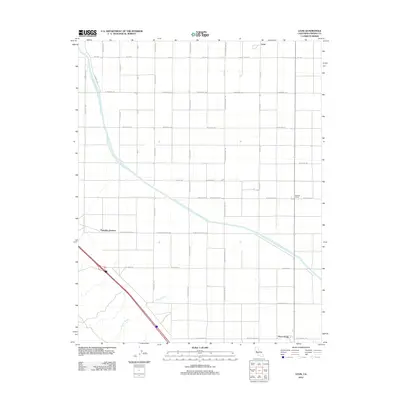
2012 Map of Levis
USGS Topo · Published 2012About this map
The Governor Edmund G Brown California Aqueduct dominates this Central Valley landscape, cutting a diagonal path through the grid of agricultural roads in western Fresno County. This 2012 survey captures the engineering required to sustain industrial-scale farming in a region defined by its strictly ordered township-and-range layout. Small agricultural hubs and junctions such as Levis and Panoche Junction serve as reference points within a network of named avenues like W Manning Ave and S San Diego Ave. To the south, the natural drainage of Arroyo Ciervo provides a sharp contrast to the straight-line irrigation channels, illustrating the intersection of the natural desert wash with human-made water management. The map also documents localized centers of activity like Midway Ranch and Three Rocks, which stand as significant landmarks for those tracing the rural development and modern land use of this arid agricultural corridor.
Find a feature on this map
25 named features on this map. Tap any name to fly to it.
Don’t see what you’re looking for? This feature index may not catch every label — zoom into the map to look around manually.
Map Details
Editions of this 2012 Levis Map
This is the sole edition of this map. No revisions or reprints were ever made.
Other maps of this area

1912 · Coalinga
USGS Topo · 1:125,000

1913 · Panoche
USGS Topo · 1:125,000

1915 · Priest Valley
USGS Topo · 1:125,000

1922 · Tufts Ranch
USGS Topo · 1:31,680

1922 · Chaney Ranch
USGS Topo · 1:31,680

1923 · Levis
USGS Topo · 1:31,680

1923 · Englebrecht Ranch
USGS Topo · 1:31,680

1923 · Monocline Ridge
USGS Topo · 1:31,680

1924 · Tranquillity
USGS Topo · 1:31,680

1931 · Mouth of Cantua Creek
USGS Topo · 1:31,680