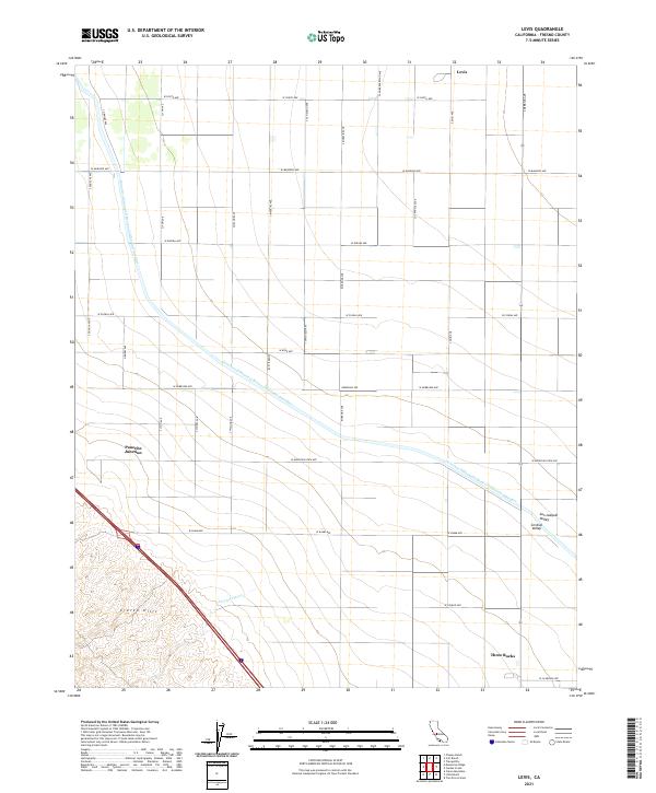
2021 Map of Levis
USGS Topo · Published 2021About this map
The Governor Edmund G Brown California Aqueduct cuts a diagonal path across this agricultural landscape, underscoring the massive water infrastructure required to sustain the San Joaquin Valley. In the southwest, the terrain shifts abruptly from the flat floor of the Central Valley into the dissected slopes of the Ciervo Hills, where the seasonal Arroyo Ciervo drains toward the plains. The map illustrates a rigid grid of section-line roads, including W South Ave and S San Diego Ave, which organize the vast tracts of farmland. Small clusters of development at Three Rocks, Panoche Junction, and the rail-aligned siding of Levis serve as the primary human touchpoints in this intensive agricultural zone.
Find a feature on this map
36 named features on this map. Tap any name to fly to it.
Don’t see what you’re looking for? This feature index may not catch every label — zoom into the map to look around manually.
Map Details
Editions of this 2021 Levis Map
This is the sole edition of this map. No revisions or reprints were ever made.
Other maps of this area

1912 · Coalinga
USGS Topo · 1:125,000

1913 · Panoche
USGS Topo · 1:125,000

1915 · Priest Valley
USGS Topo · 1:125,000

1922 · Tufts Ranch
USGS Topo · 1:31,680

1922 · Chaney Ranch
USGS Topo · 1:31,680

1923 · Levis
USGS Topo · 1:31,680

1923 · Englebrecht Ranch
USGS Topo · 1:31,680

1923 · Monocline Ridge
USGS Topo · 1:31,680

1924 · Tranquillity
USGS Topo · 1:31,680

1931 · Mouth of Cantua Creek
USGS Topo · 1:31,680