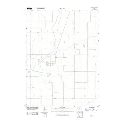
2010 Map of Lewis
USGS Topo · Published 2010About this map
The East Nishnabotna River carves a winding path through this portion of Cass County, anchoring the town of Lewis. This area displays the grid-like precision of Iowa's rural road system, where routes like Lansing Rd and Richland Rd delineate the agricultural landscape. The town center is marked by the Lewis Post Office, while the Oakwood Cemetery sits just to the northeast, serving as a significant site for genealogical research. Multiple waterways converge in this territory, including Spring Creek, Turkey Creek, and Baughmans Creek, which dictate the local topography and historical drainage patterns. The settlement pattern here reflects a stable agricultural community centered around the river valley, with the rural sections divided into large parcels typical of the Midwest's productive heartland.
Find a feature on this map
33 named features on this map. Tap any name to fly to it.
Don’t see what you’re looking for? This feature index may not catch every label — zoom into the map to look around manually.
Map Details
Editions of this 2010 Lewis Map
This is the sole edition of this map. No revisions or reprints were ever made.
Other maps of this area

1954 · Omaha
USGS Topo · 1:250,000

1957 · Omaha
USGS Topo · 1:250,000

1958 · Omaha
USGS Topo · 1:250,000

1971 · Walnut
USGS Topo · 1:24,000

1971 · Wiota
USGS Topo · 1:24,000

1971 · Atlantic
USGS Topo · 1:24,000

1971 · Atlantic SW
USGS Topo · 1:24,000

1971 · Anita SW
USGS Topo · 1:24,000

1971 · Lewis
USGS Topo · 1:24,000

1978 · Griswold
USGS Topo · 1:24,000