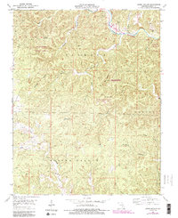
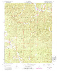
1951 Map of Lewis Hollow
USGS Topo · Published 1985About this map
Ozark National Scenic Riverways and the Current River anchor the northeastern corner of this 1951 survey, capturing a transition in Ozark land management. The area is dominated by established state-protected lands, including the Hartshorn State Forest and the Sunlands-Burr Oak State Wildlife Area. A prominent local landmark, the Hartshorn Lookout Tower, stands near the junction of several drainage systems. The landscape is defined by an intricate network of hollows, such as Lewis Hollow and Hieronymus Hollow, which feed into major water systems. Deep in the central section, the Skunk Pond State WMA surrounds the small Skunk Pond, while the southern reaches are marked by the converging North Fork and South Fork of Black Creek in Spring Valley.
Find a feature on this map
25 named features on this map. Tap any name to fly to it.
Don’t see what you’re looking for? This feature index may not catch every label — zoom into the map to look around manually.
Map Details
Editions of this 1951 Lewis Hollow Map
5 editions found
Other maps of this area

1915 · Eminence
USGS Topo · 1:62,500

1917 · Eminence
USGS Topo · 1:62,500

1932 · Cedar Grove
USGS Topo · 1:48,000

1945 · Round Spring
USGS Topo · 1:62,500

1946 · Summersville
USGS Topo · 1:62,500

1947 · Sinkin
USGS Topo · 1:48,000

1948 · Summersville
USGS Topo · 1:62,500

1949 · Round Spring
USGS Topo · 1:62,500

1949 · Rolla
USGS Topo · 1:250,000

1951 · Montauk
USGS Topo · 1:24,000