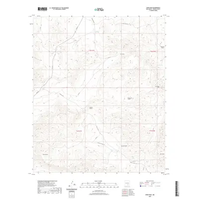
2020 Map of Lewis Peak
USGS Topo · Published 2020About this map
Lewis Peak rises as the dominant landmark in this high-altitude landscape of Chaves County, where a complex network of canyons and draws defines the terrain. The presence of Cedar Hill Lake and livestock watering points like Cox Tank and Lee Tank indicates the essential role of water management in this arid region. The geography is carved by distinct drainages such as Cox Canyon, Pretty Bird Canyon, and the winding Crooked Canyon. Transportation is facilitated by a grid of rural routes, including Cauhape Ranch Rd and Mountain Top Ranch Rd, which connect remote ranching operations across the Pretty Bird Hills. The map provides a detailed look at the public land survey system, illustrating the township and range divisions that have historically structured land ownership and grazing rights in the New Mexico backcountry.
Find a feature on this map
23 named features on this map. Tap any name to fly to it.
Don’t see what you’re looking for? This feature index may not catch every label — zoom into the map to look around manually.
Map Details
Editions of this 2020 Lewis Peak Map
This is the sole edition of this map. No revisions or reprints were ever made.
Other maps of this area

1954 · Carlsbad
USGS Topo · 1:250,000

1958 · Carlsbad
USGS Topo · 1:250,000

1962 · Dunken
USGS Topo · 1:62,500

1963 · Cornucopia Canyon
USGS Topo · 1:24,000

1963 · Robertson Canyon
USGS Topo · 1:24,000

1965 · Lewis Peak NE
USGS Topo · 1:24,000

1965 · Chimney Lake
USGS Topo · 1:24,000

1965 · Lewis Peak
USGS Topo · 1:24,000

1965 · Bullis Spring Ranch
USGS Topo · 1:24,000

1965 · Pinon Ranch
USGS Topo · 1:24,000